


Gaming/Gamificaton
Jakita Thomas, Philpott Westpoint Stevens Associate Professor, Computer Science and Software Engineering

Jakita Thomas’ popular course Game Design for Social Change is inherently international simply due to the mix of domestic and international students attracted to the subject. Using that student diversity as a springboard, Thomas assigns students to work in groups designing board and computer/mobile/video games that address an issue aligned with the UN’s Sustainable Development Goals. Students have designed games in that class that address a range of global issues from racism to female genital mutilation. The student groups brainstorm several game ideas as a group, which they present to the larger class and then the class votes on the idea they think is the best. Groups decide whether they want to pursue that game idea or another one of their ideas, which generates discussion about the ideas themselves and the culture and systems that surround the issue they want to address.
ArcGIS StoryMaps
Stephanie Rogers, Professor, Geosciences

StoryMaps allow you to take your students on a virtual adventure by exploring maps, images and stories from around the world. Whether the faculty member develops his or her own StoryMap depicting unique insights, data and educational material or whether students are tasked with using their creativity to display what they’ve learned, these interactive tools provide a way to visualize and make connections between facts and ideas. Stephanie Rogers’ Geographic Field Methods course allowed students to do just that.
Google Maps and Google Earth
Andy Gillespie, Assistant Provost for International Programs
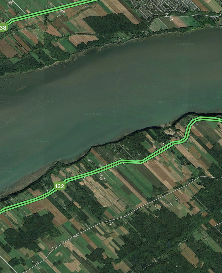
Today, satellite imagery and aerial photography are widely available to explore landscapes and land uses across different parts of the globe. Andy Gillespie commonly uses Google Maps and Google Earth in his sustainability classes to provide students with examples of land uses that are uncommon or different in the U.S. from those found in other countries. Historical imagery and 3-D effects can also enhance the immersive experience for the students as they look through time and space at points of interest that help to bring international perspectives, both visual and intercultural.
Photos and Videos & Virtual Tours
Lacey Armstrong, Executive Director, Joseph S. Bruno Auburn Abroad in Italy Program
Experiencing the food from another culture is a quintessential aspect of travel, and while Lacey Armstrong and her colleagues might not be able to provide students a literal taste of Italian food they have created an online culinary tour to transport students and inspire them to try their own dishes at home.